Smart Navigator


Do you know that the error in determining a person’s
position in space via GPS reaches 50 meters? We know! Our developers
have managed to reduce this error. We have created a mobile
application Smart Navigator which allows determining the user's
location with an accuracy of the angle in the room.
It is based on the trilateration method using iBeacon.
The name of the client, the project goals, and details
are all under the NDA. But we can share with you the implemented technical features.
300
iBeacons used
17 000
hours of iOS & back-end development
20+
team members
1 000
liters of coffee
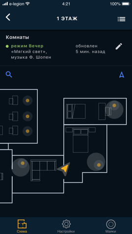
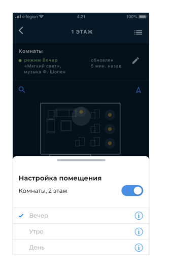
Our task was to create a system that would adapt to the location
and habits of the house owner. To localize the position, we've made
a special version of the Bluetooth beacons, created a mathematical
model of the user's environment, and several mobile applications
for configuration and use of the system. The server was integrated
with the existing real-time home control solution which allowed to provide
users exactly those management objects that were around them at the moment.

In this project we did:
Analytics
Prototypes
Design
Development
Testing
Support
Map processing
We decided to store the data about the premises, borders, and objects indoors in SVG format. Then, the map was uploaded to the server which automatically recognized the premises and objects. The server allowed providing the map with additional data: the name of the premises, the texture for the objects, the functions possessed by the objects, the access rights for a specific user, and much more. As a result, after processing the map, the app knew everything about everything including the location of the radio beacons.
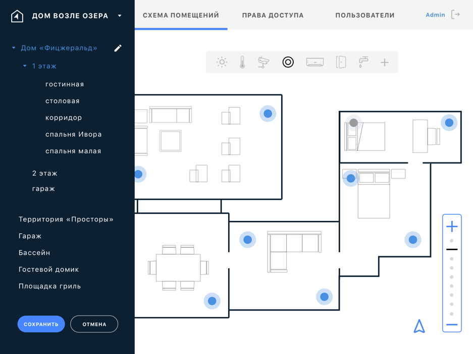
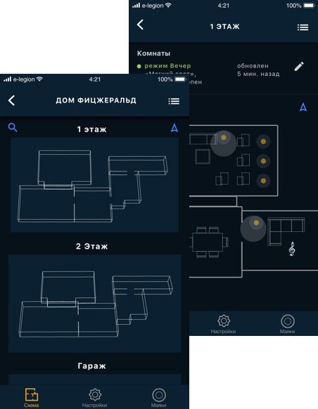
Animation and perspective
Since it was not only a room but a whole building, we have
implemented a convenient zoom and beautiful animation
to display a map of all floors premises in perspective.
For indoor navigation, a special version of the radio beacon
was developed which could operate in both iBeacon mode and BLE mode
to increase the frequency of transmitted signals. The combination
of data gave the best result for determining the location.

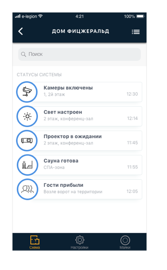
Real-time object state
Another interesting technical challenge was keeping the map up to date. Turned off lights or opened window — everything is automatically updated in the app.
For this:
- the server was integrated with hardware data sources,
- we have developed a server interaction protocol via sockets with a mobile application in real-time.
In addition to all the technical achievements of the project,
we have gained unique experience in developing complex administrative tools
on Ajax technologies as well as in creating a data privacy system.

Need a similar app?
Email us via hello@e-legion.com
Take a look at this project